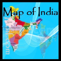
Geography of India
India is the seventh largest country
in the world in terms of area. It is the biggest
country in Southern Asia, which covers an area about
one-third the size of Europe. The Indian
subcontinent is surrounded by three different water
bodies and is easily recognisable on the world map.
The mainland of India extends between
8°4' and 37°6' N latitude and 68°7' and 97°25' E
longitude. The Tropic of Cancer 23°30' N divides
India into almost two halves.
population. Area:
1,269,339 square miles (3,287,263 sq km)
Bordering Countries: Bangladesh, Bhutan,
Burma, China, Nepal and Pakistan
Land
frontier : 15,200 km
Coastline: 7,517 kilometers.
Lowest point on land: Sea level
Hemispheres: Northern and Eastern
Time zones: 3:30 P.M. = noon GMT in West; 6:30 P.M. = noon GMT in East
The country can be divided into these distinct geographic regions: the Himalayan
region in the north, which contains some of
the highest mountains in the world, the
Indo-Gangetic Plain, the Desert
Region, and the plateau
region in the south and central part.
Himalayan Region:
India comprises the Himalayas in the North and
Northeastern region, which divides the country from
the Tibetan plateau. The Indian part of Himalayas
covering an area about 5 lakh sq km (about 16.2% of
country’s total geographical area) and forms the
northern boundary of the country. These great range
of mountains separates India, along its
north-central and northeastern frontier, from China
(Tibet), and extends between latitudes 26°20’ and
36°40’ North, and between longitudes 74°50’ and
95°40’ East.
The Indian Himalayan Region
spreads through 10 states of India namely, Jammu &
Kashmir, Himachal Pradesh, Uttaranchal, Sikkim,
Arunachal Pradesh, Meghalaya, Nagaland, Manipur,
Mizoram, Tripura, and hill regions of Assam
and West Bengal.
The Great Himalayas Mountain ranges
is the world’s highest mountain range and home to
planet’s highest Mountain peaks. Major Himalaya
mountain peaks are situated in the Karakoram
ranges,Garhwal Himalaya and Kanchenjunga. The
highest Himalaya Mountain Peaks in India are
Kanchenjunga,Nanda Devi and Kamet. Most of the peaks
are situated in the Uttarakhand state of India.
Read more about the
Himalayas
The
Indo-Gangetic Plain: The Indo-Gangetic
Plain is also known as the Great Plains or the North
Indian River Plain, is dominated by three major
rivers - the Ganges, the
Indus and the Brahmaputra. It cover a large area of
about 7,00,000 sq km in the Northern and Eastern
India, the most populous parts of Pakistan, and
virtually all of Bangladesh. The Indo-Gangetic plain
(including regions of Pakistan, India, Nepal, and
Bangladesh) is generally characterised by fertile
soils, favourable climate and an abundant supply of
water.
Some geographers subdivide the
Indo-Gangetic Plain into three parts: the Indus
Valley (mostly in Pakistan), the Punjab (divided
between India and Pakistan) and Haryana plains, and
the middle and lower Ganga. These regional
distinctions are based primarily on the availability
of water. By another definition, the Indo-Gangetic
Plain is divided into two drainage basins by the
Delhi Ridge; the western part consists of the Punjab
Plain and the Haryana Plain, and the eastern part
consists of the Ganga-Brahmaputra drainage systems.
The great plains are sometimes
classified into four divisions:
-
The Bhabhar Belt
- is adjacent to the foothills of the Himalayas
and consists of boulders and pebbles which have
been carried down by the river streams.
-
The Terai Belt -
lies next to the Bhabar region and is composed
of newer alluvium. The region is excessively
moist and thickly forested and receives heavy
rainfall throughout the year.
-
The Bangar Belt
- consists of older alluvium and forms the
alluvial terrace of the flood plains. In the
Gangetic plains, it has a low upland covered by
laterite deposits.
-
The Khadir Belt
- lies in lowland areas after the Bangar Belt.
It is made up of fresh newer alluvium which is
deposited by the rivers flowing down the plain.
The Desert Region:
The Desert regions are: The 'Great desert' extending
from the edge of Rann of Kutch beyond the Luni river
northward, embracing the whole of Rajasthan-Sind
frontier, and the "Little Desert" extending from the
Luni river between Jaisalmer and Jodhpur up to the
north. Between both the deserts is rocky waste.
Below the state of Punjab and extending southwest
along the Pakistani border is the sparsely populated
Thar Desert. This desert covers most of the state of
Rajasthan, and 3,000 square kilometers (1,158 square
miles) of its terrain of sand dunes and flat thorn
scrub is protected as the Thar Desert National Park.
The Deccan Plateau and
Peninsula Region: The largest of India's
plateaus are the central Malwa Plateau between the
Aravali and Vindhya Ranges, the Chota Nagpur in the
northeast of the peninsula, and the Deccan Plateau.
The Deccan Plateau and Peninsula, extending south of
the Vindhyas is geologically the oldest portion of
the Indian land. The name Deccan, which means
"south," is often applied loosely to all the
elevated land of southern India. More properly,
however, it refers to the western portions of the
irregular central plateau. The Aravalli, Vindhya,
Maikala and Ajanta mountain ranges separate this
Plateau from the Gangetic plain. The Deccan plateau
system averages about 762 meters (2,500 feet) in
elevation in the west and about 305 meters (1,000
feet) in the eastern parts.
Climate of India:
India's climate is also varied but is tropical in the
south and mainly temperate in the north. Much of the
subcontinent depends on the winds from the monsoon to
blow rain across the Indian Ocean from June to October.
The plains in the north, are less dependent upon the
winds than is peninsular India because those rivers are
fed by melting mountain snows. he country encounters
four different types of seasons - winter, summer,
monsoon, and post-monsoon. In some states, the
temperature in summers rise up to 45°C and minimum
temperature decreases to 15°C only. In winters, the
average temperature is about 10-15°C.